MANILA, Philippines – The weather disturbance looming to enter the Philippine area of responsibility Thursday afternoon has intensified into a storm from tropical depression, the state weather bureau said.
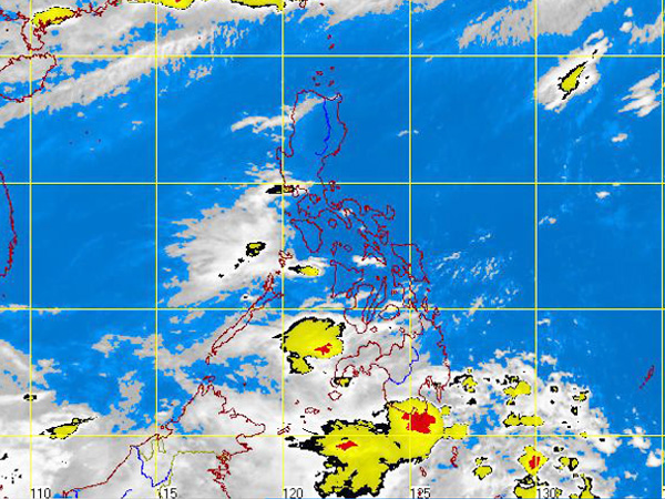
MTSAT ENHANCED IR Satellite Image for 8:32 a.m., 13 June 2012
It was seen 1,480 kilometers off the Pacific Ocean, and could enter through the eastern borders of the PAR, said Dick Manalo of the Philippine Atmospheric Geophysical and Astronomical Services Administration (Pagasa).
It had maximum sustained winds of 65 kilometers per hour and was moving at an average of 15 to 20 kph, Manalo said.
It will be named Butchoy, he said, once it enters the PAR.
Pagasa’s gale warning advised fishing boats and other small seacrafts not to venture out into the sea while larger vessels are alerted against big waves.
Meanwhile, a shallow low pressure area in Mindanao and a southwest monsoon in Luzon were also expected bring rains in parts of the country, the state weather bureau said.
At 2:00 a.m., the shallow low pressure area was seen 210 kilometers east of Northern Mindanao.
Northern and Western Luzon will experience monsoon rains while Mindanao will have cloudy skies with scattered to widespread rainshowers and thunderstorms which may trigger flashfloods and landslides, Pagasa said.
Western Visayas will experience mostly cloudy skies with scattered rainshowers and thunderstorms. The rest of the country will be partly cloudy to cloudy with isolated rainshowers or thunderstorms, it added.
Moderate to strong winds blowing from the Southwest will prevail over Luzon and Western Visayas and the coastal waters along these areas will be moderate to rough. Elsewhere, winds will be light to moderate coming from the Southwest with slight to moderate seas.
Comments